
Analysis-ready SAR data is now quicker, easier and cheaper to access
Agri-food Data Marketplace releases faster, more affordable and usable method for accessing Synthetic Aperture Radar (SAR) for UK fields. Applications include yield estimation, crop identification and remote crop scouting.
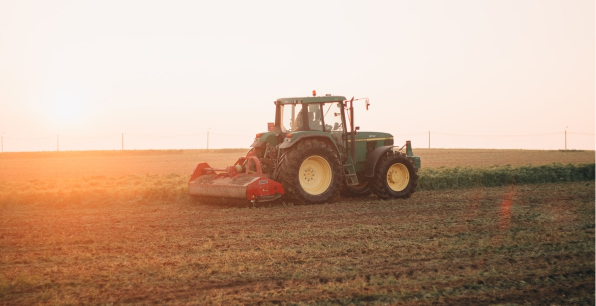
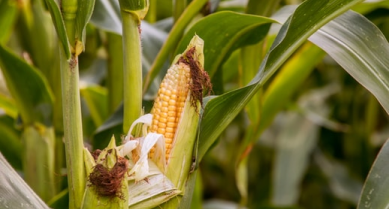
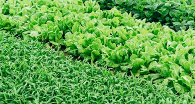
Synthetic Aperture Radar (SAR) is one of agriculture’s most promising satellite technologies. Unlike satellite remote sensing, SAR can see through clouds and below the vegetation canopy. It has important applications for crop identification, growth monitoring, and yield prediction.

The ability to provide continuous and undisrupted observations – even in poor light conditions and heavy cloud cover – is a major advantage of SAR.
Unfortunately, accessing SAR has not been easy. It would take 12 months to acquire four years of UK data from the European Space Agency (ESA) using standard technology. Storing the resulting 48 terabytes of SAR images could cost more than £12k a year. Once acquired, these images, covering 200km x 250km, are not ideal for field-level observations as they require significant pre-processing
“SAR has a lot of valuable applications and we wanted to make using it easier and more affordable,” says Dr Matthew Smith, Chief Product Officer at Agrimetrics. “Our Data Marketplace cuts 12-months of processing down to a couple of minutes. Data storage costs are slashed; vast computational costs are virtually eliminated. And vitally, Agrimetrics SAR comes pre-linked to data from a range of other providers.”
SAR from Agrimetrics is available for every field in the UK from 2017 to the present day. It is included in their standard data subscription, which means it comes pre-linked to a wide range of other field-linked data, including weather, soil, and previous cropping.
Pre-linked to more than 1billion datapoints to improve usability
Crop growth models are one example of the value of SAR and the importance of linked-data. SAR can be used to indicate the status of a crop; however, models also require other data, e.g. historic weather, forecast weather, and soil information. Previously, these datasets would have been accessed in different formats and would have required manipulation before becoming compatible.
“Through our Data Marketplace you can obtain all of these datasets together,” continues Matthew. “By accessing all these data via our API, you can insert them analysis-ready directly into your model. This bypasses lots of traditional cost and complexity – allowing you to get on with your analysis.”

The Data Marketplace employs the latest linked-data technologies to connect radically different datasets into an analysis-ready format.
Another feature of the Data Marketplace is the ability to obtain only the required data. For example, if a researcher needed to obtain SAR data for a selection of fields throughout the UK, they would previously have had to acquire the 250x200km square image that contained each chosen field; each image would then need to be processed to provide field-level data.
Using Agrimetrics Data Marketplace, individual field data can be acquired. This reduces costs and saves time. The same is true of numerous other datasets, from providers including Natural England and the Centre for Ecology and Hydrology (CEH).
To illustrate this, Agrimetrics have published an example Crop Growth Model that uses SAR and weather data.
“It’s not uncommon for more than half of a project’s lifetime to be devoted to data transformation. Months or years can be spent turning raw data into a usable format before any meaningful analysis can be conducted, products built or models tested. By creating a single linked-Marketplace of analysis-ready data we’re reducing costs and timelines for a vast range of food and farming projects.”
Importance of Synthetic Aperture Radar (SAR) for Agriculture
Remote sensing technology is now widely used in agriculture. Crop management systems typically offer satellite images as a layer within their mapping functionality; digital agronomy is one of agri-tech’s fastest growing sectors.
However, these systems have typically relied on ‘optical remote sensing’ to provide parameters such as leaf area index (LAI), crop biomass, and NDVI. These data are easier to work with and can provide valuable insight given the correct weather conditions; unfortunately, weather conditions in many parts of the world are often less than favourable.

SAR can travel through cloud and obtain information below the vegetation canopy cover. It can also operate in the dark.
This means that SAR is capable of continuous and undisrupted observations. An image is taken every six days in the UK dataset available from Agrimetrics. This is particularly beneficial for time-sensitive crops at key parts of the season.
According to a recent study, SAR has been understudied and underutilised compared with its optical cousin. However, its ability to operate without disruption means SAR has great potential to improve in-season crop area identification, crop growth models, and yield estimations.
“We’re hoping that by radically improving the accessibility of SAR and pre-linking it to other relevant data that we’ll accelerate the work of innovators in these key areas,” concludes Matthew.
Sample data available
Agrimetrics have opened their data catalogue for the research farms of Rothamsted Research and The University of Reading, two of their founding partners, plus 18 randomly chosen fields throughout England and Wales. This includes SAR, a suite of optically based parameters from Airbus – including LAI, NDVI, Leaf Water Content – soil data, previous cropping, historic and forecasted weather, and a range of ecological indicators.
Access sample dataFind out more
About Agrimetrics
Agrimetrics is the food and farming sector’s Data Marketplace. We enable organisations to safely share and monetise their data, whilst making it easier for data-consumers to access the information they need. Our goal is to help create a more productive and sustainable food system by enabling next-generation solutions as quickly and affordably as possible.
We are one of four centres for agricultural innovation founded with an initial investment from Innovate UK. Our founding partners are NIAB, SRUC, Rothamsted Research and The University of Reading. We have strategic partnerships with Airbus and Microsoft and are a participant in Microsoft’s prestigious AI for Earth programme.
Other articles that might interest you
AI identifies crops from space with 90% accuracy
Agrimetrics launches CropLens AI, a proprietary algorithm that identifies crop types from space.
ClearSky: Cloud free satellite data for agriculture
ClearSky's artificial intelligence removes a major barrier to the efficacy of satellite
ClearSky: Cloud free satellite data for agriculture
ClearSky's artificial intelligence removes a major barrier to the efficacy of satellite
Agrimetrics partners with Airbus to reduce cost
Crop Analytics, a crop and field analytics package from Airbus, is now available at a new, lower price.
Sign up for Agrimetrics newsletter
To get regular updates on new data sets, tips, trends and case studies, please subscribe to the Agrimetrics newsletter.

