
Hackathon shows value of Linked Data
Agrimetrics supports Agri-tech East’s second agri-hackathon
Data made available by Agrimetrics has been used at Agri-tech East’s second agri-hackathon. The goal was to provide novel answers to some of the biggest challenges facing the agri-food sector
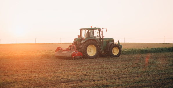
On July 6th, participants from a range of disciplines descended on the Allia Future Business Centre for Agri-tech East’s second agri-hackathon. Their goal was to provide new and novel answers to some of the most pressing questions facing our sector, including biodiversity, water management, emissions, and soil health.
The event was supported by Agrimetrics, along with Barclays Eagle Labs, BASF and WWF-UK and welcomed specialists from a range of disciplines, including software developers, electronics engineers, biologists, physicists, farmers, vets and industry professionals. This included Monika Solanki, Principal Data Scientist at Agrimetrics.
In support of the event, Agrimetrics provided access to Field Explorer, a product which brings together more than a billion linked data points for 2.7 million UK fields. This includes information from DEFRA, Natural England, USDA, Met Office, Soil Grids and the RPA to provide data on historic and forecasted weather, soil composition, cultivation, previous cropping, topography and a variety of water quality and natural capital metrics.
Novel solutions to big problems
Attendees were divided into 5 teams, each competing to create the most innovative, pragmatic and effective solutions. Two of these teams made extensive use of Agrimetrics’s Field Explorer.
The first of these, Eco-Sense, focused on how to optimise microbial activity by controlling soil moisture. They extracted field level data on crop type and soil from Field Explorer and used this in combination with outputs from a purpose-built sensor. The goal was to measure and identify the optimum soil moisture content to maximise microbial activity. Judges praised the novel, yet affordable, use of technology and awarded Eco-Sense second place.
YEL also made extensive use of Field Explorer API’s to develop a tool that uses machine learning to help farmers assess the biodiversity of their fields. They used data on rainfall, temperature and humidity to build an understanding of how environmental factors and soil properties impact biodiversity. This, in turn, was used as a proxy for assessing biodiversity.
Judges praised both of these teams for showcasing the value of linked data, especially the combination of Agrimetrics data with other external data sets. (The relative ease by which data provided by Agrimetrics can be linked with other data sets is a key benefit of the platform.)
They also commented on the potential to create a more robust biodiversity assessment, by linking further data sources – a potentially time consuming and technically demanding task made simpler by Agrimetrics.
In first place were Alpaca Punch, who developed a mechanism for quickly and easily identifying the insect species present in a field. When combined with weather data, direction of travel could be ascertained and early warning systems for farmers developed. Judges commented on the importance of sharing data to understand pest dynamics in the wider landscape.
The importance of Linked Data
All of these solutions demonstrate the importance of sharing and linking data. Sensor technology, for example, may inform a farmer about which pest species are in his fields, but a network of connect sensors enriched by relevant external data could revolutionise pest management.
This is exactly what Agrimetrics was created to do, to enable simple, affordable access to linked data, which organisations can use to create game-changing solutions

Anna Woodley
Head of Sales, Agrimetrics
Other articles that might interest you
AI identifies crops from space with 90% accuracy
Agrimetrics launches CropLens AI, a proprietary algorithm that identifies crop types from space.
ClearSky: Cloud free satellite data for agriculture
ClearSky's artificial intelligence removes a major barrier to the efficacy of satellite
ClearSky: Cloud free satellite data for agriculture
ClearSky's artificial intelligence removes a major barrier to the efficacy of satellite

Agrimetrics partners with Airbus to reduce cost
Crop Analytics, a crop and field analytics package from Airbus, is now available at a new, lower price.
Sign up for Agrimetrics newsletter
To get regular updates on new data sets, tips, trends and case studies, please subscribe to the Agrimetrics newsletter.

