
Measuring Nature: Why it is important and what it can do to help your business – Part 5
How do satellite systems work?
What can location data tell us?
How does this help precision farming?
Having considered the use of imagery from satellites and the insights they provide to agriculture we now need to consider another space-based technology in the form of global navigation satellite systems and the images they help to locate.
Satellites systems provide time and location data
In the same way that Hoover and Biro are brand names that are often used in place of vacuum cleaner and pen, GPS has done the same for global navigation satellite systems (GNSS) such as the American owned and operated Global Positioning System. Whilst it has been running since 1978 and available for use to everyone outside the US military since the mid-1990s, it’s one of four separate satellite GNSS constellations which can provide accurate global location information. The other three are the European Union’s Galileo, Russia’s Global'naya Navigatsionnaya Sputnikovaya Sistema (GLONASS), and China’s BeiDou Navigation Satellite System.

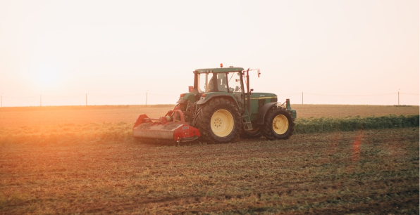
Aerials attached to sensors in cars, ships, goods vehicles, and phones receive time and position signals from at least three of the satellites in a constellation. By understanding the differences in time between when the signals were sent and when they were received, these sensors can locate themselves with respect to the satellites. The sensor’s software then coverts that information into where it is on Earth. There’s a lot going on in your phone when you’re looking for an address and it also explains how tractor tracks are so straight and uniformly spaced.
Satellite imagery and data helps precision farming
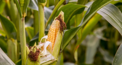
Satellite imagery and the data from GNSS allows farmers to adopt a more data led decision-making approach. For instance, knowing how much fertiliser is needed in a certain part of a field or how well a crop is growing is only useful if you know how and, crucially, where to act. Crop production inputs are expensive and wasting them on areas that don’t need help will reduce efficiency and ultimately profitability.

Precision Farming, which is driven by a combination of satellite imagery and GNSS location information, allows farmers to divide up a field and treat each cell, which can be as small as 100 centimetres square, with the right amount of care and attention that it needs. Where an acre, a hectare or a field used to be the base unit of area in farming, now we can be so much more accurate and improve the crop yields by considering these much smaller subdivisions.
Glossary:
GNSS: a Global Navigation Satellite System
Precision Farming: Using satellite position data and remote sensors to adopt data led farm management decision-making.
Other articles that might interest you
AI identifies crops from space with 90% accuracy
Agrimetrics launches CropLens AI, a proprietary algorithm that identifies crop types from space.
ClearSky: Cloud free satellite data for agriculture
ClearSky's artificial intelligence removes a major barrier to the efficacy of satellite
ClearSky: Cloud free satellite data for agriculture
ClearSky's artificial intelligence removes a major barrier to the efficacy of satellite
Agrimetrics partners with Airbus to reduce cost
Crop Analytics, a crop and field analytics package from Airbus, is now available at a new, lower price.
Sign up for Agrimetrics newsletter
To get regular updates on new data sets, tips, trends and case studies, please subscribe to the Agrimetrics newsletter.

