
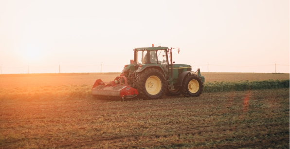
Seven reasons why field boundary data will change the future of British farming
From improving the usability of crop management applications to condensing days of research into minutes, field boundaries promise to revolutionise our sector
Never before have we had access to so much information about our food and farming systems. From vast archives of historic data to satellite imagery to in-field sensors – the options are diverse and numerous. But this data is only valuable if it can be accessed, analysed and connected. In doing so, we can deliver insights that define advancements in management practices. Agrimetrics’ Field Boundaries tool provides a shortcut for achieving this.
In September 2019, Agrimetrics announced the release of their data-linked Field Boundaries. Professor Richard Tiffin, Chief Scientific Officer at Agrimetrics, describes Field Boundaries as a “cookie cutter for data“, which enables data that could previously only be viewed by region or county to be viewed and analysed from the perspective of an individual field.
But what are the application of field boundaries for the agri-food sector? In this article, we look at seven stakeholder groups from across the supply chain to show how field boundary data can change the landscape of food production.
1. Developers can improve the user experience of farmer facing applications, tools and software
Traditionally, many farmers have been critical of farm management software. Users complain that products are not intuitive or user-friendly, they’re not practical to use on-farm and are too time-consuming. Many of these complaints can be alleviated with the help of Agrimetrics Field Boundaries.

FarmHand is an application developed by Glas Data, which enables farmers to visualise, analyse and benchmark more effectively. Agrimetrics Field Boundaries are enabling them to improve capabilities and user experience
Historically, growers using crop management software would have to input field boundaries by manually drawing the perimeters using their computer’s mouse, or uploading machine data as they drive the perimeter of their fields. This is a time consuming task which often produces inaccurate results. For larger businesses managing multiple farms or locations, this task can seem insumountable. This inefficiency has discouraged widespread uptake and use of these tools and systems. arguable, this has held the sector back.
However, with Agrimetrics data-linked Field Boundaries, agritech businesses can pre-load these parameters, allowing farmers to download their boundaries at the touch of a button. Depending on the subscription level, these boundaries can come complete with a range of relevant metrics, such as historic and forecasted weather, soil composition, previous cropping and topography.
Because Agrimetrics provides access to this information via API, it can be easily intergrated with third party content and software. The goal is for the field becomes the single point of truth, uniting a vast array of relevant information.
This maximises value for farmers and revenues for developers.
2. Land agents can explore and mange assets more efficiently
Negotiating land deals and planning land usage is a core part of a land agent’s role. To deliver this level of advice, detailed knowledge is required of every asset. The field-level data enabled by Field Boundaries has the potential to give land agents their most powerful tool to date.
This is perfectly explained by Richard Tiffin:

Field boundaries could enable high value producers, such as vineyards, to identify suitable fields in unexpected places
“Imagine a champagne producer looking to expand their sparkling wine portfolio. The Champagne region is synonymous with quality; particular soils, climate, elevation and rainfall all contribute to the unique taste that defines wine from that region. As UK wines are increasing in popularity, and perhaps also due to climate change, this producer wants to launch a sparkling wine that is reminiscent of their established brand in a new location.
“A land agent would be tasked with finding the ideal location for this new vineyard – a time consuming process which often relies on high levels of intuition and local knowledge. However, with Agrimetrics Field Boundaries, a new vineyard could be found based on the criteria already known about the estate in Champagne. Potentially, tens of thousands of UK fields with the same growing conditions could be found in a matter of seconds. Each field can be benchmarked against all others and, with the application of an algorithm, a hierarchy can be formed and a decision made.
Although the South East of England might be an obvious choice for this producer, some interesting alternatives could be discovered, paving the way for a unique and profitable opportunity.”
3. Producers can make better management decisions
For large-scale producers and agri-businesses, field boundaries can support management decisions, both on-farm and in the supply chain.
One example of how field boundaries can be used is Barfoots. This global food and farming company utilise predictive modelling to forecast overseas harvest dates and then use this data to manage fluctuations in their supply chain.
Agrimetrics developed a machine learning algorithm alongside Barfoots which analysed historical data in order to understand the variables affecting crop growth. When provided with the relevant field-level information, forecasted weather and sensor data, the algorithm was able to predict future crop growth and use this information to indicate an optimal harvest date.
This would have been impossible without the ability of field boundaries to act as a ‘cookie cutter’ for other datasets.
“It’s important to remember that field boundaries are rarely the end goal for businesses. Rather, boundaries are the essential foundations for creating other solutions,” says Anna Woodley

Anna Woodley
Head of Sales, Agrimetrics
4. Macro-level researchers can inform field level management decisions
Researchers often focus their efforts on small on-farm experiments, studying the impact of specific variables in controlled scenarios. These can provide useful insights, but their limited scope hinders wider adoption. Conversely, other researchers will focus on the macro-environmental picture, often uncovering insights which though important have limited practical applications for the farmer.
Field Boundaries allow researchers to exploit the best of these two research types by enabling field-level insights to be drawn from large research studies. Alongside this, Field Boundaries accessed through Agrimetrics have the advantage of being linked with other field-level metrics.
“Let’s take crop disease as just one example,” explains Kathyrn Berger, Data Science Team Leader, Agrimetrics. “If we take fields where crop disease has previously broken out, then we can begin to extrapolate what they have in common. Additionally, by looking at how crop disease has spread, we can begin to understand the variables influencing how it travels.
“We can then build models which predict future outbreaks, based on forecasted weather and crop type. This can inform the creation of early-warning systems for at risk fields. It can also flag farms which are not at risk – enabling agrochemicals to be used more sustainably.”
“Without field boundaries this nature of work would be far more complex and far more costly, if it were possible at all.”

Kathryn Berger
Data Science Team Leader, Agrimetrics
5. Agrochemical companies can help growers make more effective and sustainable decisions
With increasing environmental pressure and a consumer-driven push towards sustainable farming practices, agrochemical companies are looking for ways to optimise product usage and manage regulatory risk.
A recent example of this is ‘wHen2g0’, a tool developed by BASF and Agrimetrics to improve water stewardship by informing growers decisions on when to apply metazachlor and quinmerac to oil seed rape crops.
To achieve this, Field Boundaries were used as a filter for viewing and analysing a range of relevant variables, including proximity to watercourses, predictive and historical rainfall data, soil type, cultivation and topography. Growers enter coordinates or select their field from a satellite image of the UK, and based on these variables are provided with guidance on whether or not it is safe to spray on any of the next 7 days.
The outcome of this is improved product efficacy (because it stays in the field), more rigorous environment protections and an ability to demonstrate better management of regulatory risk, which is being demanded by Government and the general public.
Even though most of the required information was publicly available, only Field Boundaries made the development of this smart tool possible.
6. Agronomists can provide a more effective and efficient service to their clients
Agrimetrics data-linked Field Boundaries have the potential to improve agronomic services in a range of ways, a few of which are detailed below:

Field boundary data will enable agronomists to provide more efficient, effective services to growers
1. They provide standardised field boundaries which can be used by both farmer and agronomist (and other members in the agri-food value chain, e.g. input manufacturers). This can improve accuracy and streamline processes.
2. They provide the building blocks for developing new and better solutions for farmers. This is especially prevalent now, as more and more agronomy firms are investing in digital platforms to host and improve their services. Just like with pure agri-tech companies, data-linked field boundaries have the potential to fast-track the development of these products, improve functionality and user experience.
3. Agrimetrics field boundaries are linked to a range of field-level parameters (such as weather, soil, topography and previous cropping). Some of this information may be available elsewhere, but accessing it via Agrimetrics promises a significant time saving, whilst viewing the information in one place makes analysis and decision making easier.
4. Finally, just as with other large agribusinesses, field boundary data provides a mechanism for sorting and analysing an organisations own data. This can lead to new insights which can inform both commercial and agronomic strategies.
In the near future
Shortly, Agrimetrics field boundaries will be linked to precision satellite data. This will enable agronomists to remotely scout the fields of their clients. Combined with analytical models, they will automatically detect anomalies, highlight pest and disease risk, monitor and predict crop performance. They will even enable action at the sub-field level.
7. Agribusinesses can improve customer and consumer intelligence
Many corporate agribusinesses are awash with data. Information will be held across multiple systems that are not always fully compatibale with one another. Often, businesses will hold or have access to all of the information they need to answer a question, but lack the technical capabilitiy to bring that information together.

For the first time, data from multiple sources and formats could be brought together and viewed from the perspective of the field
Agrimetrics and Field Boundaries can provide a mechanism for understanding that data in a way which produces maximum value for the business and their customers from the lens of the field.
For example, a corporate agribusiness could view all of their customer data from the perspective of a field and combine this with other information, like previous cropping and topography (both available via Agrimetrics), or third-party data.
On its own, this would provide salespeople and marketers with a valuable resource from which to inform conversations and campaigns. This would benefit the company by increasing the ROI of these activities and benefit the farmer by improving relevance.
Taken one step further, machine learning could be used to identify trends and patterns. This could inform product recommendations and marketing campaigns. It could also generate unique insights which could form the basis of new product development or benchmarking reports – both of which produce a tangible benefit back to the farmer.

Find out more about Agrimetrics data-linked Field Boundaries
Find out more
About Agrimetrics
Agrimetrics is one of four agri-tech centres at the heart of the UK Government’s Agricultural Technologies strategy. Our mission is to catalyse innovation in the sector through the use of big data and advanced analytics. We do this by providing easy and affordable access to data, a platform for sharing and connecting complex data, and our own data science and AI expertise. You can read more about our work here.
About the four centres
The Agri-Tech Centres are a unique collaboration between Government, academia and industry to drive greater efficiency, resilience and wealth across the agrifood sector. A £90m investment from the UK’s strategic innovation agency (Innovate UK) is enabling the Centres to harness leading UK research and expertise as well as build new infrastructures and innovation.
Other articles that might interest you
AI identifies crops from space with 90% accuracy
Agrimetrics launches CropLens AI, a proprietary algorithm that identifies crop types from space.
ClearSky: Cloud free satellite data for agriculture
ClearSky's artificial intelligence removes a major barrier to the efficacy of satellite
ClearSky: Cloud free satellite data for agriculture
ClearSky's artificial intelligence removes a major barrier to the efficacy of satellite

Agrimetrics partners with Airbus to reduce cost
Crop Analytics, a crop and field analytics package from Airbus, is now available at a new, lower price.
Sign up for Agrimetrics newsletter
To get regular updates on new data sets, tips, trends and case studies, please subscribe to the Agrimetrics newsletter.

