
Measuring Nature: Why it is important and what it can do to help your business - Part 2
How do satellites take images?
How do we know we can trust the results?
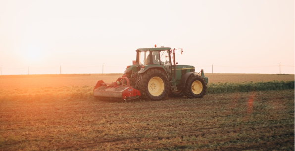
How can it work for farming?
In the first part of our series, we looked at what earth observation means and how we take images from space to help improve farm management and crop yields.
In this instalment, we will look at how sensors are able to see beyond the visible and how it allows us to measure the health and vitality of crops.
How do satellites take images?
Many of the orbiting satellites which look down at us from around 750 kilometres above our farms use sunlight to create their images. Just like an everyday camera, the pictures are created by capturing the light that reflects off the scene below.

Some sensors even send out their own radar pulses and use those reflections to create an image, known as Synthetic Aperture Radar (SAR) systems. Agricultural applications for SAR systems are developing rapidly, including crop identification and yield prediction but, for now, we will concentrate on the passive, optical options.
Visible light, which we use to see, is only a very small part of the enormous amount of information flowing around the world, called the electromagnetic spectrum. Whilst we can only see the red, green and blues of visible light, satellites have been designed and built to see beyond that narrow band of the electromagnetic spectrum that we use.
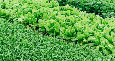
How can these images help farmers?

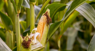
A common application for this extra information is to create a Vegetation Index. Using combinations of red light (which we can see) and near infra-red light (which we can’t), satellite sensors are able to create a map that shows the relative health of the crops below.
This works because healthy plant cells absorb red light and reflect a lot of the near-infrared light. So, in a growing plant, more photosynthesis will mean more cells and hence more absorption and reflection. This helps us identify healthy plants and highlights those that are not doing so well.
How can we trust the results?
Each group of wavelengths that the sensor can detect is referred to as a ‘band’. Since it is these various combinations of bands that are so useful when deploying satellite imagery, we need to know how good the sensor is at defining its bands if we are to trust the results. This is measured by the spectral resolution of the sensor and those with a higher value can discern more wavelengths.
The easiest way to understand this is to consider the difference between colour and black and white film. The former uses three bands (red, green and blue) to create the image whilst the latter, only one (greyscale). The number of bands that satellite sensors can operate varies widely but it can be into the hundreds.
So now we have a first understanding of the spectral resolution of sensors that create images for use in farming and agriculture and what they can show us. Next, we will look at temporal resolution, or put more simply, how many times a day do I have a satellite above me?
Other articles that might interest you
AI identifies crops from space with 90% accuracy
Agrimetrics launches CropLens AI, a proprietary algorithm that identifies crop types from space.
ClearSky: Cloud free satellite data for agriculture
ClearSky's artificial intelligence removes a major barrier to the efficacy of satellite
ClearSky: Cloud free satellite data for agriculture
ClearSky's artificial intelligence removes a major barrier to the efficacy of satellite

Agrimetrics partners with Airbus to reduce cost
Crop Analytics, a crop and field analytics package from Airbus, is now available at a new, lower price.
Sign up for Agrimetrics newsletter
To get regular updates on new data sets, tips, trends and case studies, please subscribe to the Agrimetrics newsletter.

